Printed Bird's-Eye View of Tudor London
Printed Bird's-Eye View of Tudor London
Out of stock
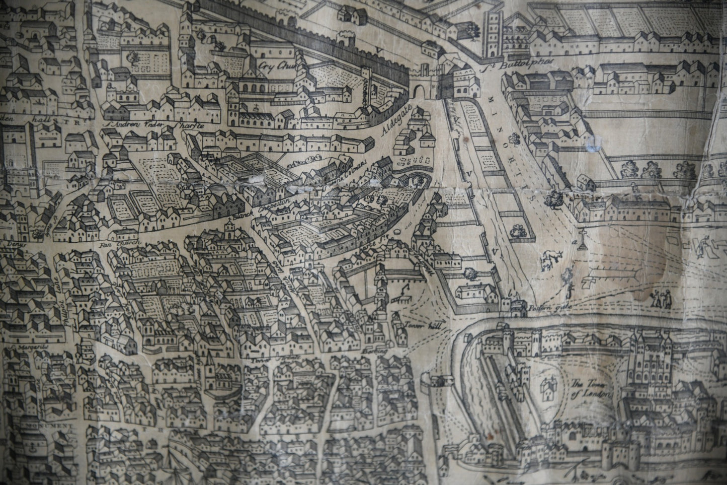
Printed bird's-eye view of Tudor London. Late 19th Century map of London in the reign of Queen Elizabeth; lithographic panorama from the south, based on the earliest surviving printed map of London, by Ralph Agas. Printed on two sheets conjoined, published by Cassell, Petter & Galpin. Issued to subscribers to a Victorian journal on London's history.
Dimensions: 135cm x 60cm including frame. 124cm x 59cm.
Condition: Framed and under glass, ripples and creases, damage and deterioration in places.
Free delivery quoted covers England and Wales only. Delivery offered is an economy service to ground floor with a single driver. Express and two man delivery service is available, please make enquiries for prices. Delivery to Scotland and Islands also available, please contact us for prices.
SKU:9966516